Field Trip to Lago Buenos Aires
I used the four month to plan my first own-organized field trip. I have to admit that I was super nervous at the beginning and I couldn´t sleep the night before. I guess I started with a bunch of sleep lack into the field trip. The team also joined my "Co-Strategyst" Gregor Lauer-Dünkelberg, who is also will be part of the CUAA program and who works in the north of Argentina in Salta and Jujuy with paleoseismology, as well as my "Pre-Strategyst" Julia Drewes and her husband who also supported me strongly for my master thesis. Of course my supervisor Diego was on board as well. I had a team of five persons who helped me to get an overview of the landscape.
Midst of September is unfortunately not an optimal time to get your field work done in Patagonia. A lot of people warned me about the strong winds and the minimal chances of flying a drone.
It was not the wind which prevented us from flying, but rather the rain and snow intervened. The area is arid with a mean rainfall of 200 mm/yr. You wouldn´t expect 3 out of 5 days with rain. Nevertheless, strong winds were no crucial factor anymore.
I would have liked to write a daily report about the field trip. But both the sleep lack and the missing WIFI connection made it difficult. Though, our accommodation was really nice. Directly located the Lago Buenos Aires I could test the freezing water temperatures by myself. Los Antiguos and Perito Moreno are the biggest villages down there around the Lago Buenos Aires. Because more of the planned locations were located near the western and the northern side I decided to put my home base to Los Antiguos. The little village will become quite touristic in the future. Not only the perfect locations and mesmerizing panorama views are an eye catcher also the production of several types of berries and fruits will attract more and more tourists.
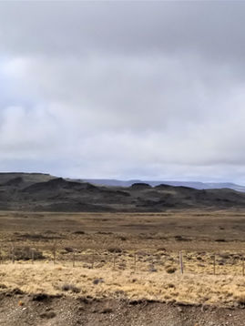
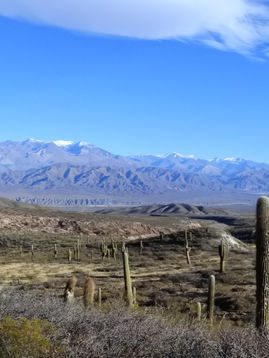
The landscape is amazing! The Andes in the background with their snow-pitched peaks and the combination between lake, the plateau and beautiful hills made it so special. Though we had a lot of rain the landscape doesn´t seem to be dismal or grey.
But not only the touristic parts were wonderful, in a scientific viewpoint the area is also highly interesting. Cascades of landslides are visible. Different ages, different sizes. From mega-landslides of the plateau, to kilometer long earthflows and small debris flows. You can´t drive around a corner without noticing more mass movements. It is a textbook-like condition. Due to the arid conditions the landslides are good preserved. The scarps are clearly visible and often you can find the hummocky terrains and some lakes in between the depressions.
This field trip was designed as a first scouting of the zone. What we planned was to discover possible routes to the locations and mark spots which seemed to be interesting. My minimum expectation was set as this. But we went out of the field with a whole new hypothesis. We were able to fly drone and produce DEMs of the landslides and take samples for further investigations.
Though our start was quite slow because everyone had to accustom to the new conditions. Flying a drone and producing air-born pictures was at the beginning quite nerve-wrecking. With the App Pix4D I had planned every flight as detailed as possible. But of course, I have never flown the drone on my own in the field. So I didn´t know for example that the drone was not adapting to the relief regarding the flight height. Was the flight height set to 100 m and the highest peak 120 m in your planned area, the drone will crash. Thanks to a small vibration of the controller I noticed the approaching danger and could sent the drone to their home base. Speaking of which.... Forgetting to update your home base was also a minor problem. But due to good luck we saw the drone flying above us back to the previous home point and I was able to maneuver to drone back to our location within the battery limits. I have learned to handle a bunch of new and difficult situations. But in the end the drone was safe and sound. I wouldn´t speak of myself of being an expert now, but I can teach someone the main mechanics and handlings of a drone and a few aspects which has to be kept in mind during the flight.
In the evening we were able to produce a DEM of the taken pictures. The structures of the moraine and the transition to the earthflow were really good visible. Although I wished I had made pictures from a higher location. But next February we will return and hopefully manage to fly a drone again.
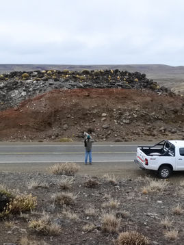
I have revealed that we had also managed to create a new hypothesis. Thanks to my supervisor who is more into realizing geologic characterizations we set our focus to the lithology as well. At the eastern side of the plateau the basalt flows are underlined by continental tertiary clays and silts. This material act like soap to the overlying basaltic blocks. We don´t know the actual mechanics at the moment, but what we saw was a clear text-book like lateral spread of the blocks of the rotational landslide. The question now is if the very gravitational force of the block is enough to cause spreading or if the weight of glaciers or the melt water of those caused the spread. Moraine deposits were found nearby which originated likely of the Great Patagonian Glaciation and are part of the Telken moraine complex. This would mean that the slides are older than 1 Myrs and the lateral spread was caused during the withdrawal of the glaciers.
It would be very interesting to examine the mechanical conditions of the clayey material and simulate the lateral spread. This could give us an idea about the other rotational slides as well. Actually I don´t know if the tertiary material underlies the basaltic plateau at all locations. But indeed this could explain the formation of such big rotational slides.
I want to leave a few words on the area and on the people as well. I mentioned above that one main task was to check-out possible accesses to the plateau. Often people possess small (or big) proportions of land, the so-called estancias. This land belongs to the people and can be used in the way they want. Maybe as agriculture ground, for cattle farming or for selling it to the mining industry. Finding an access to the estancias can be quite nerve-wrecking. If you are lucky you can visit the owner and ask for permission to go onto the land. But sometimes the entrances of the land are locked and there is no way you can go and visit what you would like to see. This is one thing we have tried to figure out. An Argentinian supervisor the worth a million in this situation. Speaking with the people in the native language (though my Spanish is not so bad!) and convince them that we are not from the mining industry but do really scientific stuff, can´t be done by foreigners. We spoke with a few people from different farms and we also got a few keys but unfortunately the big doors were remained closed. It seems that one family owns a lot of land near the plateau, who can´t be easily reached.
But it was nevertheless worth it. We found out that the area will become a national park in the future. All the formal conditions are met by now and just the law is missing. We also went to the contemplated walking trail which led up to the plateau itself. The ways are quite good and cabins for resting and for setting your tent are already built. However, nobody was there as we reached it. Indeed, it is possible to drive until the onset of the landslide area with a car, although I suspect that is officially not aloud.


